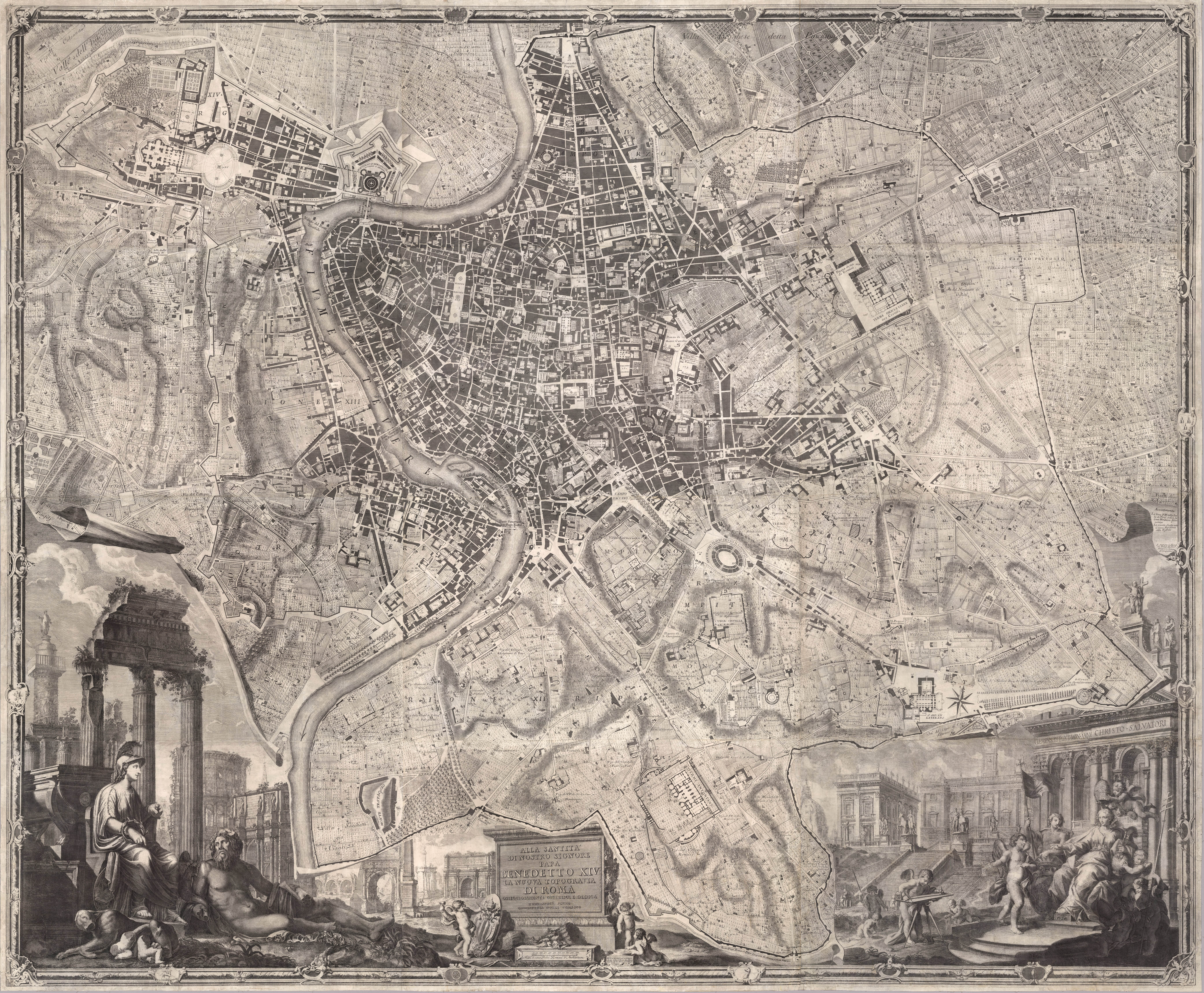
Nolli Map, GIAMBATTISTA NOLLI, ROME, Italy, 1748 AD

view of Nolli Map
Giambattista Nolli designed this well-known drawing and map in 1748, encapsulating the urban fabric of central Rome at this date. The drawing is a large scale image depicting central Rome at the time, and the many landscape areas surrounding the city. Often only sections of the drawing are shown in relation to particular projects, several discussed throughout this book. Nolli challenged how to depict the city of Rome by understanding the positive and voided masses of the city.
In a typical figure ground drawing, shaded areas define positive masses while unshaded or white areas define void of mass. Nolli expanded the relationship in this map to define shaded areas as private spaces. The white areas of the map were defined as more public spaces, including interior of buildings such as the Pantheon. The drawing is a compelling way to rethink the city of Rome, a city well known for many public spaces. Streets and piazzas are depicted as voids, clearly understood as public realm. The map highlights the street organization from the Baroque Replanning of Rome, featuring streets connecting religious buildings through the city. Rome is the center of the Christian world with many churches defined as public spaces. The Nolli map further reinforces the religious fabric mapping the connections between many churches and courtyards as a network through the city. The shaded areas are reserved as private areas contrasting from and framing the public areas of the city.
University of Oregon created The Nolli Map Website featuring an interactive Nolli map which allows a person to turn on or off specific features such as Tiber River, gardens, districts, fountains, city walls and gates, map icons and contemporary satellite image. A comparison of the satellite image to Nolli map illustrates how Rome is organized rather similar today as it was over two hundred and fifty years ago.
Media Attributions
- 1748 Nolli Map of Rome is licensed under a Public Domain license
